Posts Tagged ‘DC Boundary Stones’

Jones Point Contest Answer

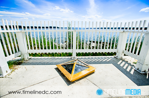
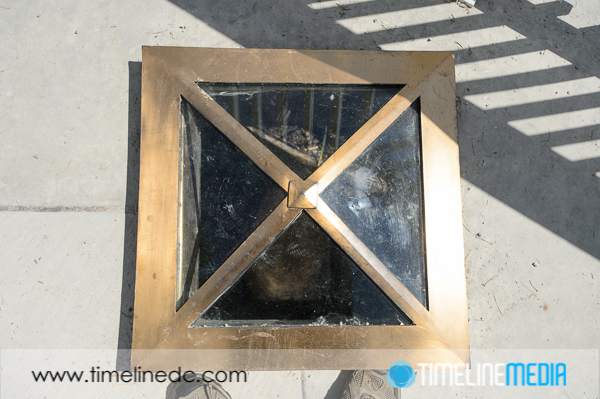
Glass covering the South DC Boundary stone

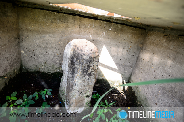
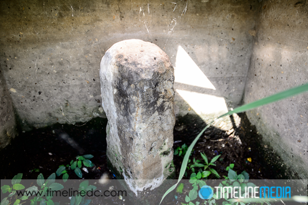
A few posts ago, I asked if anyone could tell how this photo was taken. It is the first boundary stone that was placed at Jones Point in Alexandria, VA. It marked the origin of the capital city of the United States, Washington, DC. For sure it is a challenge to get access to it. Being that it has been protected behind a seawall underneath the ground in front of the Jones Point Lighthouse.

Alexandria, Virginia

©TimeLine Media - DC South Boundary Stone
©TimeLine Media – DC South Boundary Stone

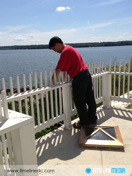
On the other side of the seawall is a very marshy area that leads to the Potomac River. I tried to walk the little ways to the window opening of the wall. Howver, the ground did not hold my weight very well. Perhaps the tide had just rolled out, and the timing was not right to walk. In any case, the overgrown brush was not trampled or stepped on. So, no one has ventured out to see the stone that way in some time.

Jones Point

©TimeLine Media - DC South Boundary Stone
©TimeLine Media – DC South Boundary Stone

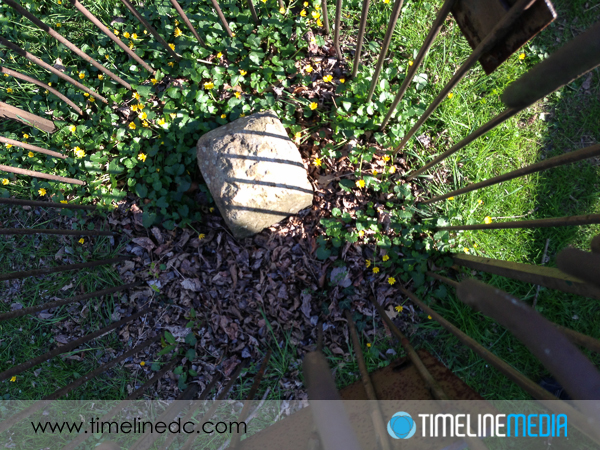
I was determined to get a photo of the stone, but the bright sun and the thick glass above the stone meant that shooting from directly above would not make it possible. Too many reflections from the glass made it impossible to see. So my wife had an idea – hang the camera from over the fence to take the photo. PERFECT!

Glass covering the South DC Boundary stone

Camera Technique

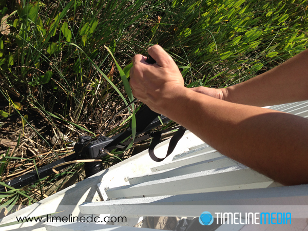
Thinking about how to go about this – a tripod or monopod mounted to the camera would give me a stable way to hold the camera, but I did not think it would be that flexible. So I just checked that the straps were extra tight on the camera before DANGLING IT OFF THE SIDE OF THE FENCE.

Dangling camera by strap over the fence

For the camera, I zoomed the wide lens all the way out to get as much of the space in the frame as I could. Then I connected the Nikon MC-30 Remote Trigger Release so that I could fire the shutter when the camera was in position, and stable since it did rotate back and forth on the trip down. From the photo, the frame would be made upside down in the camera, but that is of course, a very easy fix in software. Mission accomplished!

I would not normally recommend dangling a camera from a strap. Nor would I recommend taking photos without looking through the viewfinder or the Live View from the sensor, but sometimes extremes are necessary to get a unique image. I’m sure next time I visit, everything will be cleared away, and you can just walk up and stick your camera in the window! Let me know if you have any stories of ways you got your camera into hard to reach places.

©TimeLine Media - DC South Boundary stone - uncropped
©TimeLine Media – DC South Boundary stone – uncropped

TimeLine Media – www.timelinedc.com
703-864-8208

Jones Point Park

©TimeLine Media - DC South Boundary Stone

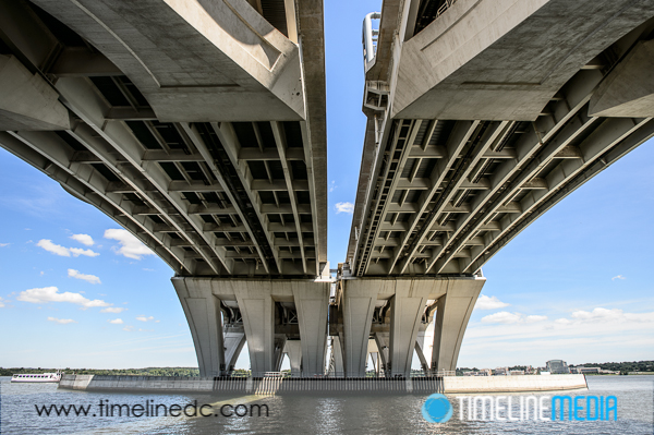
We have had a nice string of “chamber-of-commerce” days in the Washington, DC area. The weather really makes it easy to get out and make photos around town. On this day, we were interested in exploring a park that had been recently renovated after the completion of the Woodrow Wilson Bridge construction. Jones Point Park is located at the Virginia side of the bridge, and has plenty of areas for recreation from courts, bike and walking trails. The Potomac River also borders the park which provides nice views of the National Harbor, the District, and the plane traffic from Reagan National Airport. The park also sports lots of unique historical markers being so close to Old Town Alexandria, and Washington, DC.

Alexandria, Virginia

©TimeLine Media - Underneath Woodrow Wilson Bridge from Jones Point Park
©TimeLine Media – Underneath Woodrow Wilson Bridge from Jones Point Park

From a previous post, you can see some of the background on the DC Boundary Stones. These stones are the oldest federal monuments which marked out the perfect square that cut Washington, DC out of land from both Maryland and Virginia. The first stone laid in the project was at the southern corner at Jones Point. Today, the stone is protected behind a sea wall right by the shore, adjacent to the Jones Point Lighthouse.

From here, there are lines and other markers that show the original borders. In the middle 1840s, the Virginia land that was part of DC was given back to the Commonwealth. Walking the park now, they have lines marking where the old border used to be showing DC, Maryland and Virginia. Even though you cannot directly view the boundary stone, they do have a nice see-through marker above the stone so you can look down on the stone.

©TimeLine Media - DC South Boundary Stone
©TimeLine Media – DC South Boundary Stone

So here comes the FUN part! You can see how close the shore is to the stone. The ground on the other side of the fence was very soggy, and not very stable to stand. I did not feel like breaking my ankle to get a photo of the stone in the wall, so how did I get this photo?

©TimeLine Media - DC South Boundary Stone
©TimeLine Media – DC South Boundary Stone

Please send your guesses to the TimeLine Media Facebook page, or to the comments section below. The first person to correctly guess how I was able to take this photo, I will send you a coupon for $50 of prints or digital downloads from the proofing site! I will post the answer in an upcoming blog post. Good luck!

TimeLine Media – www.timelinedc.com
703-864-8208
DC Boundary Stones

©TimeLine Media - SW9 Cornerstone of DC, Falls Church, VA

Being a native of the area, I have taken for granted being so close to many historical places. Virginia’s history as part of the United States is as long as any other state. This is due to its early settlement by European explorers. With so many of the early leaders and architects of our system of government, it has always played a key role in shaping our nation.

One famous Virginian, George Washington, decided that part of Virginia should be part of the capital city. Since it is close to the middle of the original 13 states, it would donate part of its land with Maryland to make the nation’s capital city. He surveyed a perfect diamond shape for the city on a map creating Washington, DC. Today, the land under that diamond south of the Potomac River is now Arlington County, VA. This is why the District is no longer a perfect square shape. The whole story of which was recently documented in the History Channel program, “How The States Got Their Shapes“.

Federal Markers

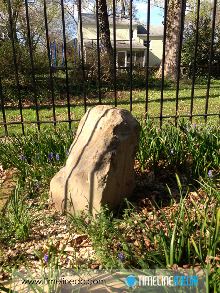
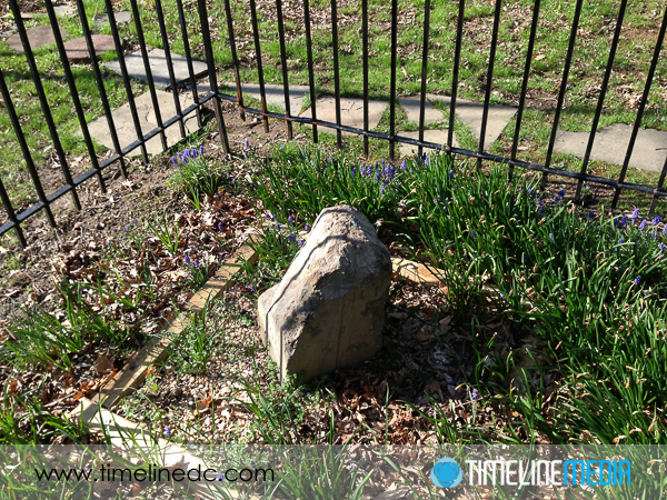
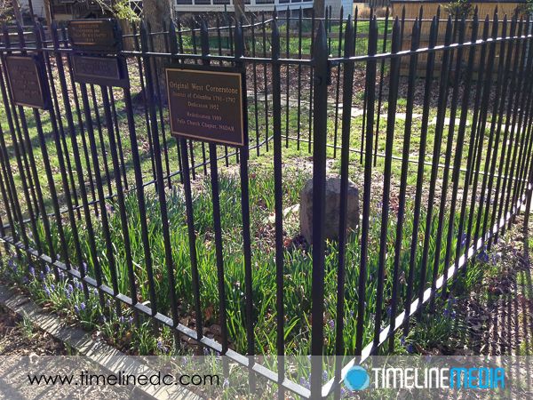
In order to mark the 10-mile boundary of the original square shape for Washington, DC, Andrew Ellicott was tasked by Secretary of State Thomas Jefferson, to place boundary stones marking the border of the city. Since moving closer to the city last year, I found out that we live very close to the stones in the Virginia side in Falls Church. We took out the smartphone to find the markers on the map, and found 2 – the West Cornertone and SW 9 stone. Both are very accessible and fenced off making them very easy to spot and view. This was a very satisfying find! I’ll be on the lookout for others.

©TimeLine Media - West Cornerstone of DC, Falls Church, VA
©TimeLine Media – West Cornerstone of DC, Falls Church, VA
©TimeLine Media - West Cornerstone of DC, Falls Church, VA
West Cornerstone of DC Boundary Stones in Falls Church, VA ©TimeLine Media
©TimeLine Media - West Cornerstone of DC, Falls Church, VA
©TimeLine Media – West Cornerstone of DC, Falls Church, VA
©TimeLine Media - SW9 Cornerstone of DC, Falls Church, VA
SW9 Cornerstone of DC, Falls Church, VA ©TimeLine Media
©TimeLine Media - SW9 Cornerstone of DC, Falls Church, VA
©TimeLine Media – SW9 Cornerstone of DC, Falls Church, VA

TimeLine Media – www.timelinedc.com
703-864-8208