Posts Tagged ‘NPS’

Foggy Great Falls

Fog descending over Great Falls, Virginia ©TimeLine Media

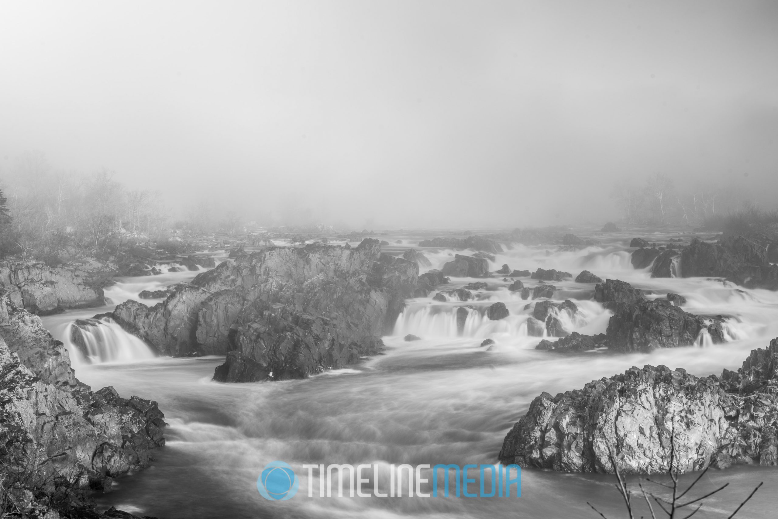
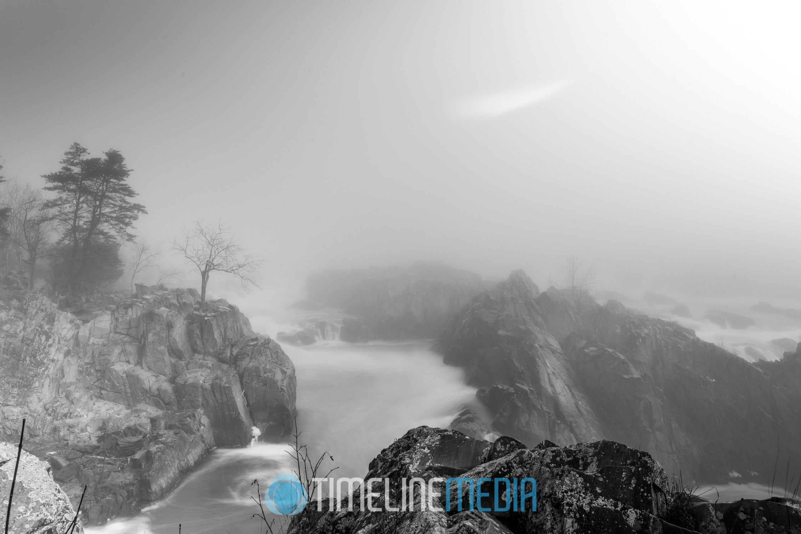
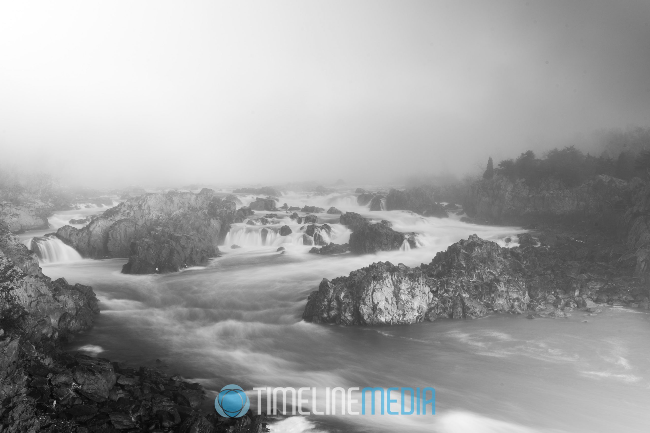
Inversion over the Falls

Late last year, a thick foggy morning motivated me to get out of the house. Landscape or nature photography is not my forte. However, a foggy Great Falls has been on my list to shoot for a while. Unlike other areas, we generally do not have very foggy days often. On this occasion, the warm morning temperature created a thick inversion over the entire northern Virginia area. So, I got in my car and looked for a place to make some photos.

Great Falls on a foggy morning ©TimeLine Media

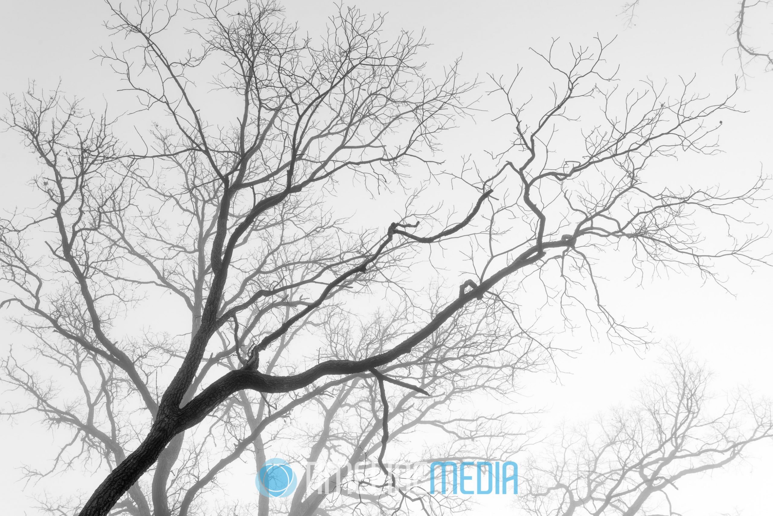
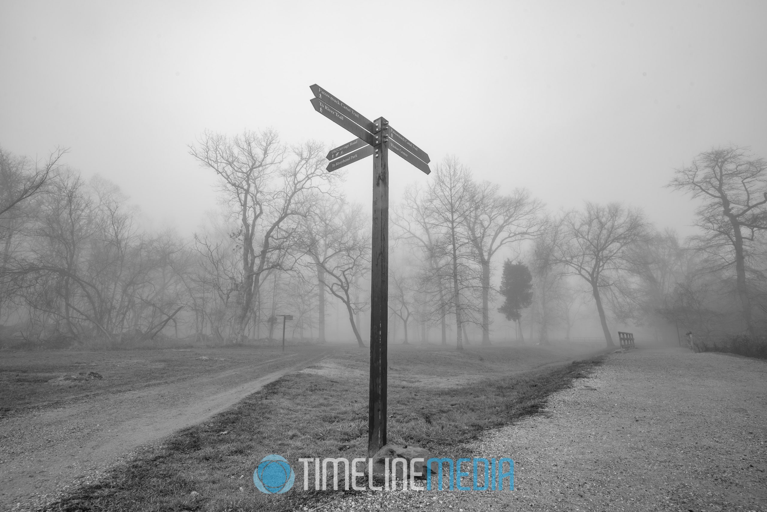
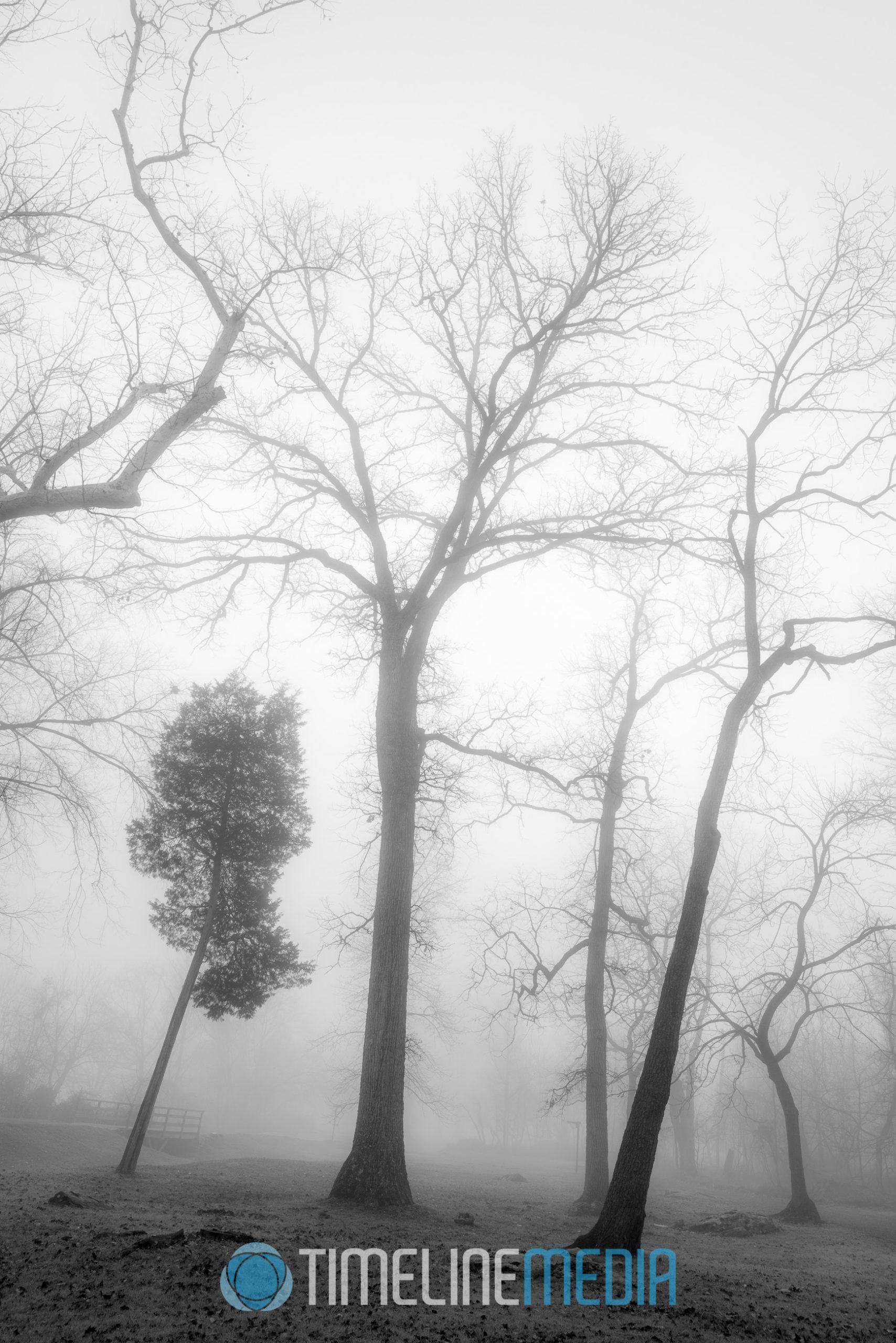
When I arrived at Great Falls Park, I knew that this would be a perfect morning for photos. Walking through the parking lot, and the park trails, the fog was still hanging in the air. I was excited about getting to the edge of the falls however, the walk through the park was just as inspiring.

Great Falls trail signs in fog ©TimeLine Media
Trees in the fog at Great Falls Park ©TimeLine Media

Finally arriving at the edge of the falls, I propped my camera on a tripod. Though it was not very bright with the thick fog and early morning light, I put on an ND filter. This smoothed out the motion of the water, and made for some nice prints later!

Fog over Great Falls in Virginia ©TimeLine Media

TimeLine Media – www.timelinedc.com
703-864-8208

DC Boundary Stones

©TimeLine Media - SW9 Cornerstone of DC, Falls Church, VA

Being a native of the area, I have taken for granted being so close to many historical places. Virginia’s history as part of the United States is as long as any other state. This is due to its early settlement by European explorers. With so many of the early leaders and architects of our system of government, it has always played a key role in shaping our nation.

One famous Virginian, George Washington, decided that part of Virginia should be part of the capital city. Since it is close to the middle of the original 13 states, it would donate part of its land with Maryland to make the nation’s capital city. He surveyed a perfect diamond shape for the city on a map creating Washington, DC. Today, the land under that diamond south of the Potomac River is now Arlington County, VA. This is why the District is no longer a perfect square shape. The whole story of which was recently documented in the History Channel program, “How The States Got Their Shapes“.

Federal Markers

In order to mark the 10-mile boundary of the original square shape for Washington, DC, Andrew Ellicott was tasked by Secretary of State Thomas Jefferson, to place boundary stones marking the border of the city. Since moving closer to the city last year, I found out that we live very close to the stones in the Virginia side in Falls Church. We took out the smartphone to find the markers on the map, and found 2 – the West Cornertone and SW 9 stone. Both are very accessible and fenced off making them very easy to spot and view. This was a very satisfying find! I’ll be on the lookout for others.

©TimeLine Media - West Cornerstone of DC, Falls Church, VA
©TimeLine Media – West Cornerstone of DC, Falls Church, VA
©TimeLine Media - West Cornerstone of DC, Falls Church, VA
West Cornerstone of DC Boundary Stones in Falls Church, VA ©TimeLine Media
©TimeLine Media - West Cornerstone of DC, Falls Church, VA
©TimeLine Media – West Cornerstone of DC, Falls Church, VA
©TimeLine Media - SW9 Cornerstone of DC, Falls Church, VA
SW9 Cornerstone of DC, Falls Church, VA ©TimeLine Media
©TimeLine Media - SW9 Cornerstone of DC, Falls Church, VA
©TimeLine Media – SW9 Cornerstone of DC, Falls Church, VA

TimeLine Media – www.timelinedc.com
703-864-8208